VanillaBryce
-
Posts
9 -
Joined
-
Last visited
Content Type
Profiles
Forums
Blogs
News
Store
Everything posted by VanillaBryce
-
 I partially agree with a lot of your points here. Great feedback! Prioritizing hydration over food could lead to many of the same engagement issues that are created by the current food system. This could be compounded by the lack of drink variety compared to foods. However, food is still very important. My main point was that you don't need to think about food as constantly as hydration when it comes to survival. I think Valheim's 3-food system actually does a good job of balancing engagement, progression, and grind. Moreover, eating 3 meals per in-game day makes logical sense. With that said, their 'meals' include several drinks. The system is probably a bit too arcade-y for Vintage story, despite being executed very well. A hydration system related to heat and tied to a 3-meal/day food system (with some nutrient buff logic) could strike a good balance. This reminds me a lot of the Valheim system, haha. I think a macro system could be viable in Vintage Story without being too grindy for this reason. Shaping your diet for buffs over time would be fun as well - it might also change your playstyle based on the environment, which could be interesting. I agree that severe injuries could really detract from the fun of the game. Striking the right balance would be important, but it has been done well before. The fallout games come to mind. They made it pretty hard to become crippled, so when it happened it was challenging, but rarely infuriating. It seems to me that Vintage Story wants to depart from its arcade-y Minecraft roots; thoughtfully implemented, consequential injuries would certainly take it more into the true survival realm. Entities would need to be adjusted to account for the mechanic, but that can be done. Bears could have a high chance to stop and warn players before attacking - even though this isn't our world, they would likely understand that humans/Seraphs are a dangerous predator. Wolves and pigs could be scripted to have a high chance to avoid players if alone, but attack if in a pack. Leaves could be scripted to reduce fall damage/slow the player. This would make the game feel much more alive, and a bit of rng could go a long way to creating more immersive wildlife encounters. The issue with subsistence is that it is just that; it is barely sufficient to maintain life. This is why people began pursuing husbandry and farming as opposed to hunting and gathering. Hunting was energy intensive, but rewarded high energy foods... Gathering kept you from starving to death while you were spending tons of energy hunting. The game already adopts this logic, but raw game is nerfed heavily because it is abundant and nerfing it incentivizes players to advance to more complex foods. Foraging can and should still be important, but meat could be buffed a bit.
 -
Hydrate or Diedrate is a great mod and I agree that some form of hydration system could be a good way to make the equatorial regions more unique if they required the player to pay more attention to their hydration. Vintage Story is an arcade-type game, but it also flirts with a more hardcore or "realistic" experience across several mechanics. However, the food mechanics are more arcade-y by design to allow players to cook more complex meals without feeling like they've wasted time. There's nothing wrong with this, but it feels noticeably incongruous with the more realistic direction the other major mechanics have gone in. I also used the word "should" a lot in the main post because I was feeling lazy. I don't believe the hydration+starvation+injury system that I proposed is the perfect remedy for the gamification of satiety. Moreover, the gameplay loop for food is a common sore point across many survival games - as you mentioned. With that said, I think it is possible to make a system that is gamified, but more in-depth than the current system without being overly grindy. For my part, I'm definitely personally biased against being forced to eat in games arbitrarily; I have lived and worked very actively without eating all the time or eating particularly well. It's just always been one of my pet peeves when it comes to survival games, because it doesn't usually add much to the game and the hunger bar feels tacked on to make it "survival-y." It seems kind of ridiculous that running around a field causes you to start dying in a game once your hunger bar hits zero. The forced progression to "better food" is also far too predictable and that ends up making it a bit boring even if the cooking, baking, and prep mechanics are done well.
-
Man, I'm glad I made this thread because this generated some interesting discussion. This is going to take a while to hash out.
-
I also think the default for the starvation system should be one day for free (as long as you aren't already starving). The first day with a zero satiety hit would put you in a deficit for day 2 (you'd have to eat double calories to be full), but you wouldn't gain starvation. In a five-point system (with one point per day of starvation), this would be a total of 6 days to reach the death phase.
-
Yeah, I think some sort of body composition system could be super cool if it was done in a way that wasn't super grindy.
-
Vintage story does a fantastic job of creating more immersive gameplay systems. Unfortunately, satiety functions in much the same way as Minecraft from the perspective of the player. There is nothing inherently wrong with the current system, because it is fairly in-depth for an arcade-type game... I honestly think it's great for the most part. However, the devs of Vintage Story are clearly aiming for more realism. How could satiety be improved? #1 Acknowledge that clean water is more important than food when it comes to survival. In real world survival situations, humans can survive for months on minimal calories so long as they have fat reserves. The same is not true for water. We must drink water every 72 hours or we will die. The gameplay loop should emphasize water consumption over food consumption. Players could be forced to boil water or find springs to drink from; else they risk a chance of contracting a serious illness from bad water. Cooking pots are fairly easy to make, and likely contain ~1-2 days worth of water, so this wouldn't be hugely burdensome. Rainwater could be collected and primitive gravity filters for unclean water could be produced to eliminate boiling requirements. This would have the benefit of reducing the forage/cooking grind that plagues survival games, while still emphasizing mindful play. #2 Seraphs should build body fat when they eat fatty and high-protein foods (mostly meat) or high-carb foods (when satiated) Food is still important, but satiated food consumption should allow the player to survive without food for days or weeks at a great cost if necessary by getting fat. Mild starvation should be the norm until the player is established, but it shouldn't just reduce player health until death - that should only occur in the latest stages. Every time the stamina bar reaches zero, the player should gain a point of starvation. Starvation could become a unique and immersive mechanic that imposes progressive and additive debuffs in stages before ultimately leading to death. These might look like: Stage 1: Reduced stamina regen and health regen Stage 2: Reduced maximum stamina Stage 3: Reduced resistance to cold Stage 4: Reduced maximum health. Stage 5: Max stamina degradation and max health degradation (until death) Realistically, 1-2 pieces of VS bushmeat (or their caloric equivalent) should be enough to stave of starvation for a day. This would have the benefit of making big game much more valuable to kill in the early game. A gameplay-balanced starvation progression might take 5 VS days if there were 5 stages, although 20-30 days would be more realistic. However, reducing starvation to a manageable level should take a long time as well. A fully starving player wouldn't have any body fat, so they would need to remain satiated for days to recover from starvation and rebuild their fat reserves. During this time, they would slowly progress back down the starvation ladder. Full recovery from stage 5 might take 10 VS days without hitting zero satiety - incentivizing players to avoid starving for too long. #3 The existing diet system could still be used, because more complex foods would readily increase body fat compared to raw meat, thereby extending progression time through starvation. Building fat by remaining satiated for a long period of time could extend each stage - perhaps from 1 VS day to 2 or 3? #4 To compensate for the lessened emphasis on constant food consumption, serious injuries could also require long recoveries and thoughtful medical attention. Meat is king when it comes to pure survival, but obtaining enough meat to stave off starvation is dangerous; this is why tribes were formed. For instance, a bite from a bear or a wolf (or a trampling from a moose) might break your limbs, causing reduced mobility or combat effectiveness for a long period of time - splints may be required. Perhaps, the player simply loses too much blood in the battle and their max health and stamina are reduced for a few days as they recover. This naturally incentivizes the player to hunt game cautiously, try their best to avoid predators, and emphasize developing safer forms of food production like farming (or crafting heartier meals) until they can stalk large prey with confidence after crafting more advanced weapons and armor. #5 Low-calorie foods (raw mushrooms, berries, veggies) could have their satiety reduced significantly, forcing the player to hunt for big satiety in the early game. Starvation mechanics would enable forage subsistence to be disincentivized further because you wouldn't start losing health immediately, but you would realize that it was unsustainable after a couple days. How do you think satiety could be improved? Should water be emphasized over food in VS? Do you think starvation should be expected and accepted as part of survival?
-
This approach also makes a lot of sense from a programming perspective. However, I think there should be a solution based on water depth instead of type, because lakes can have waves too! There could definitely be multipliers for each water type though (salt vs fresh), which modify the ceiling for the amplitude of the waves generated by the noise function. You could also perform a check on each chunk to see if it has a water block at the predefined sea level or above; if yes, the chunk must be part of a surface puddle, pond, lake, or sea. From there, you could perform more complex checks to determine the water start and stop points in each block column (with the final check set at sea level) by starting at the top of the column and finding the highest water level(s) and their corresponding depth(s). Once all the start and stop points are found, you have a surface water map. You could define rules to define the various water landforms, etc. Weather then modifies the wave function that is applied to the surface water blocks in a landform with interpolation to a calmer surface at the shoreline.
-
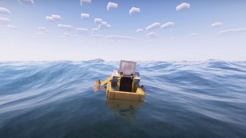
Like the title of the post suggests, some kind of waves added to the oceans would be extremely cool. The physics mod for minecraft is the best example of this sort of thing. With the new ships incoming, I think a feature like this would add a ton of fun and immersion to the game in the future. Perhaps, it could be included as part of a larger water overhaul/revisit?